


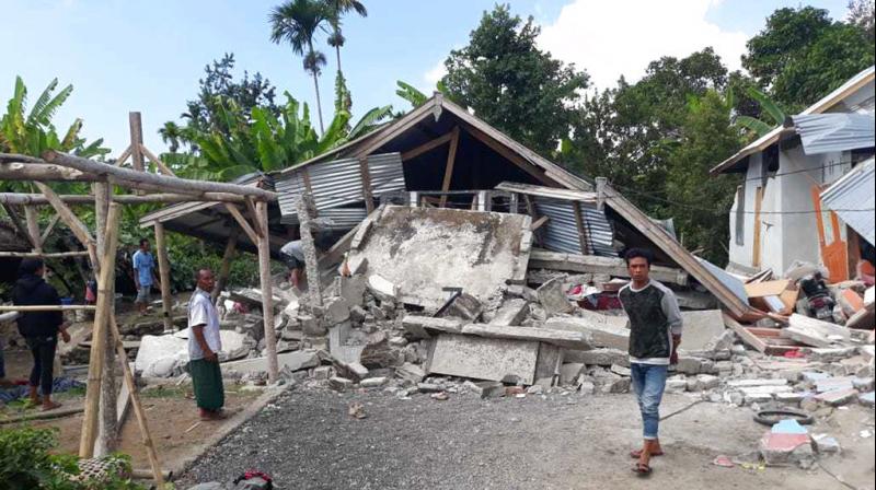
A powerful magnitude 6.1 earthquake jolted the southern region of Indonesia’s main island of Java on April 27, with no immediate reports of injuries or significant damage to property.
The U.S. Geological Survey indicated that the earthquake occurred 102 kilometers (63 miles) south of Banjar city at a depth of 68.3 kilometers (42.4 miles), without issuing a tsunami warning.
Skyscrapers in Jakarta swayed for approximately a minute, while two-story houses shook vigorously in the West Java provincial capital of Bandung and in the satellite cities of Depok, Tangerang, Bogor, and Bekasi. The tremor was also felt in other cities in West Java, Yogyakarta, and East Java province, as reported by Indonesia’s Meteorology, Climatology, and Geophysical Agency.
The agency cautioned about potential aftershocks.
Although earthquakes are common in the vast archipelago nation, they are seldom felt in Jakarta.
Indonesia, with a population of 270 million, is situated in a seismically active region and is susceptible to seismic activity due to its location on significant geological faults within the Pacific “Ring of Fire.”
In 2022, a magnitude 5.6 earthquake in West Java’s Cianjur city claimed the lives of at least 602 individuals. This incident marked the deadliest earthquake in Indonesia since the 2018 quake and tsunami in Sulawesi, which resulted in the deaths of over 4,300 people.
The devastating Indian Ocean earthquake of 2004 triggered a tsunami that caused the deaths of more than 230,000 individuals in a dozen countries, with the majority of casualties occurring in Indonesia’s Aceh province.


